Letter to Planning Director: Spring Vineyard Project – Fire Access and Prime Farmland Requirements
By Daniel Hale
Subject: Spring Vineyard Project – Questions Regarding Fire Access and Prime Farmland Requirements
Leza,
I am writing to request clarification regarding the City's processing of the proposed Spring Vineyard project, particularly with respect to two issues that appear to raise significant questions regarding compliance with the City's adopted General Plan and Municipal Code.
I would appreciate specific responses to the following:
1. Two-Fire-Access-Road Requirement
The proposed development contains more than 30 residential units. The City's Municipal Code, including SHMC §15.36.100(D), establishes a requirement for two emergency access roads for residential developments exceeding 30 units.
Why is the City not applying this requirement to the Spring Vineyard project?
Specifically:
- What provision of the Municipal Code authorizes the City to approve a development exceeding 30 units without the required two emergency access roads?
- Has the City determined that the requirement does not apply to this project? If so, who made that determination, when was it made, and what is the legal/code basis for it?
- If the requirement has been waived or otherwise deemed inapplicable, what provision authorizes such a waiver or exception?
- Was the City's Fire Department or Fire Marshal consulted regarding the applicability of the two-access requirement, and if so, what was the specific determination and when did that occur?
2. Prime Farmland and General Plan Policy LU5.G
I also have questions regarding the City's treatment of the Prime Farmland designation affecting the 1933 Spring Street property.
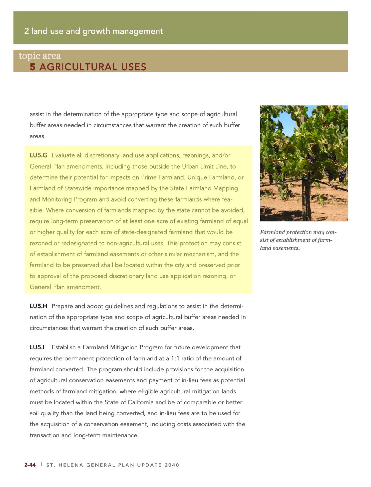
The attached excerpt from the St. Helena General Plan identifies the City's requirements for the protection of Prime Farmland under Policy LU5.G. Of particular significance is the requirement that:
"the farmland to be preserved shall be located within the city and preserved prior to approval of the discretionary land use application rezoning or General Plan amendment."
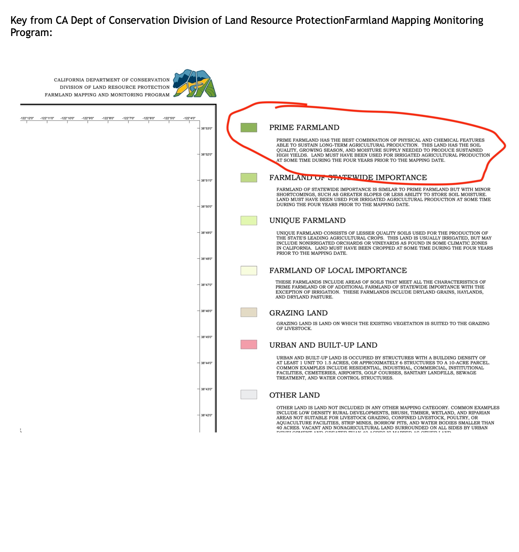
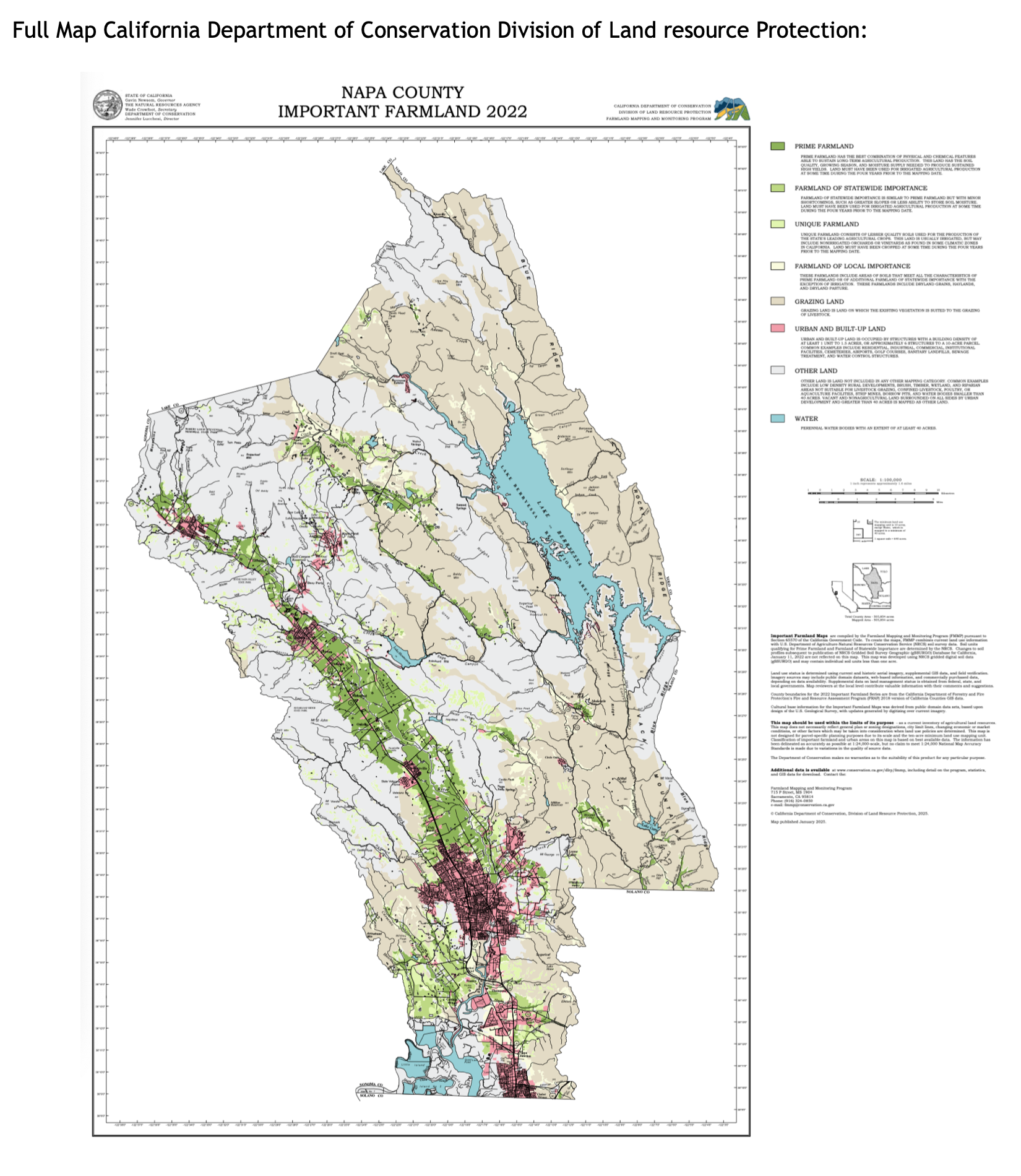
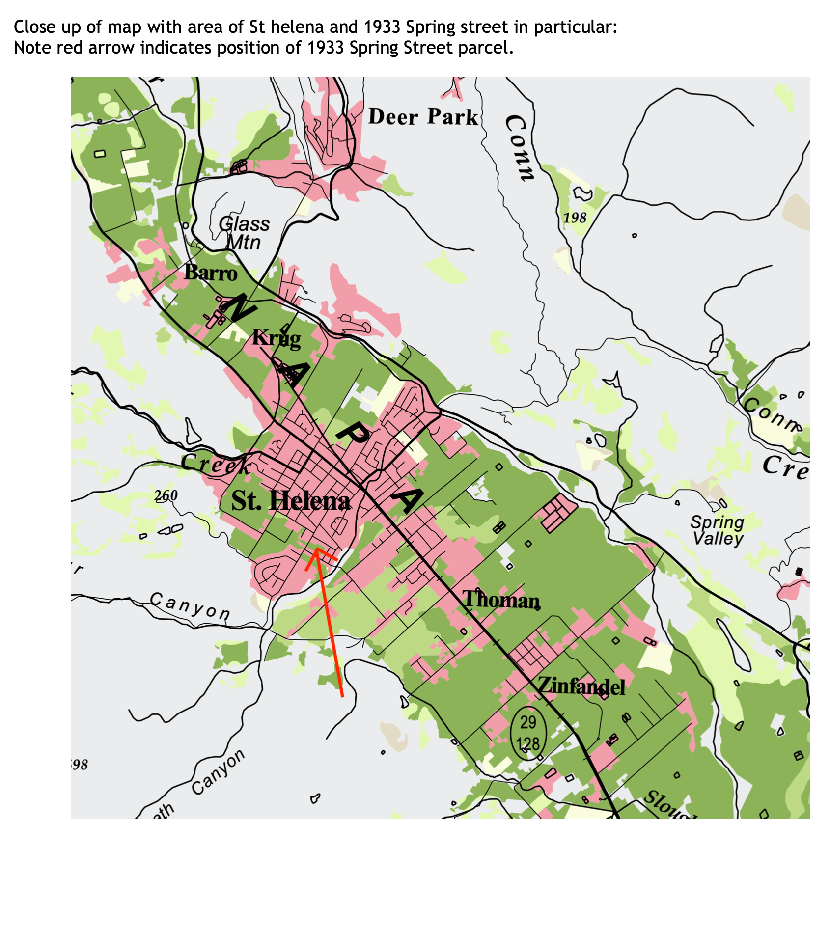
The attached California Department of Conservation, Division of Land Resource Protection, Farmland Mapping and Monitoring Program map identifies the 1933 Spring Street property as Prime Farmland.
Given that designation, why was 1933 Spring Street considered an appropriate candidate for the proposed upzoning when the property itself is identified as Prime Farmland?
More specifically:
- How did the City determine that the proposed rezoning/upzoning was consistent with General Plan Policy LU5.G?
- What farmland, if any, has been preserved within the City and prior to approval of the proposed rezoning or General Plan amendment, as required by LU5.G?
- Where is that preserved farmland located, and what action by the City formally established that preservation?
- If no such farmland was preserved in advance, what is the City's basis for concluding that the proposed rezoning complies with LU5.G?
- Was the Prime Farmland designation identified and considered during the City's evaluation of the property for upzoning?
- Was this issue addressed in the materials submitted to HCD as part of the City's housing element/upzoning process? If so, where?
I have attached the relevant General Plan excerpt and the California Department of Conservation farmland map for reference. The map appears to clearly identify the 1933 Spring Street parcel as Prime Farmland.
These seem to be straightforward questions of objective standards and adopted City policy, and I would appreciate a response identifying the specific code provisions, General Plan policies, findings, or other authority upon which the City's decisions are based. Happy to discuss. Call, text, or email with any questions.
Thank you,
Daniel Hale
Attachment: Prime Farmland
It is very clear that 1933 Spring Street should not have been deemed a candidate for upzoning, as it is listed as "Prime Farmland" on the California Department of Conservation Division of Land Resources Protection Farmland Mapping and Monitoring Program. It clearly should not have been submitted and should not have been certified by HCD. It is also clearly in violation of the objective requirements in the General Plan, as the required preservation or in-kind protection within the City limits was not done in conjunction with and in advance of the proposed upzoning.
The highlighted section LU5.G from the St. Helena General Plan and the latest edition of the State of California Farmland Map both designate the 1933 Spring Street property as Prime Farmland. Note in particular the following language at the end of the relevant paragraph:
"...and the farmland to be preserved shall be located within the city and preserved prior to approval of the discretionary land use application rezoning or General Plan amendment."
The California Department of Conservation map clearly identifies the position of the 1933 Spring Street parcel as Prime Farmland. This designation, combined with the plain language of General Plan Policy LU5.G, raises serious questions about whether the City's upzoning of this property — and HCD's subsequent certification of that action — was consistent with the City's own adopted policies.